Reply To:
Name - Reply Comment
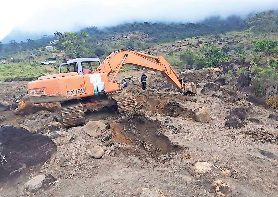
Walankanda-Suriyakanda elephant corridor in Sinharaja Forest destroyed
- 10 suspects have been produced to Manampitiya Magistrate Court on charges of illegal land grabbing and farming attempts inside the Park
- There’s a grassland spanning 2500 hectares, but 600 hectares have been taken up by the highway
- Out of the 35 farmer organisations 33 of them are against these illegal land grabs
COVID-19 wasn’t the only pandemic that struck Sri Lanka in 2020. A mass scale Ecocide began and is continuing much to the dismay of environmental activists and nature lovers who have raised their voices to protect the greeneries. The revoking of the 1/2005 and 2/2006 circulars that provided protection for Other State Forests is identified as one of the main contributing factors to this damage. Many sensitive ecosystems, some which have been identified as UNESCO World Heritage Sites, are already under threat. The current regime is under scrutiny for giving the go-ahead for several developmental activities bordering protected areas. However, the president’s directions seem to have been misunderstood by certain elements with vested interests.
Following are a few pressing environmental concerns at hand.
Land grab attempts at Flood Plains National Park
Following President’s request to release lands for agricultural purposes in Polonnaruwa those with vested interests have resorted to grabbing lands inside Flood Plains National Park. The Park made headlines during the proposed plan to develop the Yakkure Road. One officer attached to the Department of Wildlife Conservation (DWC) was transferred following a heated argument with State Minister of Wildlife Wimalaweera Dissanayake during one of his visits. Speaking on conditions of anonymity another DWC officer said that people have misunderstood what the President said. “He requested to release lands that don’t fall under Other State Forests. The law doesn’t permit people to carry out commercial activities in protected areas and areas that fall under the purview of DWC. If the law is amended we would duly expedite it,” the DWC officer said.
As such 10 suspects have been produced to Manampitiya Magistrate Court on charges of illegal land grabbing and farming attempts inside the Park. “Nine farmers and one cattle owner has been produced. As per the Cabinet decision 20/1639/314/003 lands that are excluded from Other State Forests could be utilised for agricultural purposes. It has specifically mentioned that no land falling within a forest reserve or conservation forest could be utilised. Therefore these activities are illegal. Besides it is impossible and impractical to go in for a mega scale farming programme as the export market for paddy has reduced. Instead we need to capitalise on the biodiversity and promote it for tourists.” the officer added.
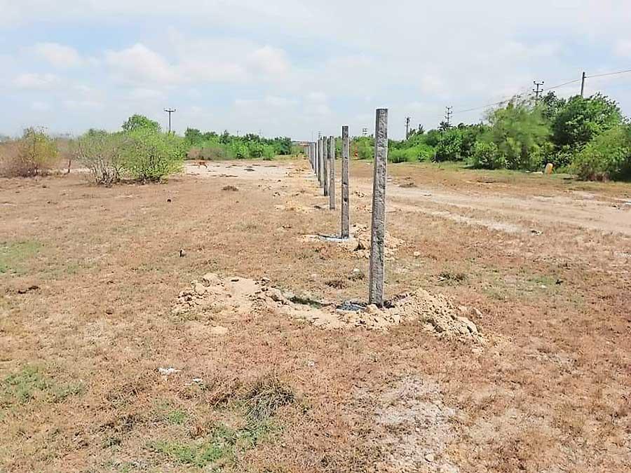
Fences put up destroying mangroves in Sambaltive, Trincomalee
Reported incidents of deforestation in 2020
Deforestation in 2021
|
Speaking on the downsides of these decisions, the officer said that so far 13 elephants have died in Polonnaruwa within this year. “Last year around 48 of them died as a result of the Human-Elephant conflict. People don’t have drinking water facilities. Besides the Flood Plains National Park is a wetland. It filters harmful pesticides before that water runs into the Mahaweli River. If the villus dry out this filtration process will not happen and people would be at the receiving end,” the office said.
The next court hearing will be in June 2021.
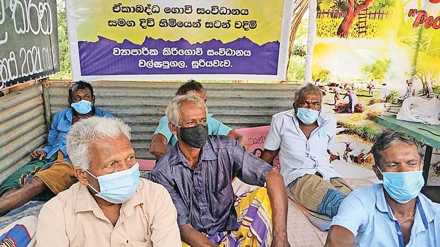
Ongoing farmer protest in Hambantota
20,000 hectares in danger
“The Flood Plains National Park is the only Wetland in the dry zone, but there’s a mass scale encroachment happening,” Ven. Nikapitiye Chandima Thera, Chairman of the People’s Movement to Protect Flood Plains National Park. “Illegal farming practices are happening in places such as Veheragodayaya and there is information that there’s tree felling, sand mining and other prohibited activities happening within this Protected Area. The Wasgamuwa-Somawathiya elephant corridor falls across the Flood Plains National Park. Cases have been filed against people who cultivated in areas within the Park. Several local politicians also tried to motivate cattle farmers to send their cattle into the Park,” the officer said.
"There are two hotels and people have drawn water and electricity supplies into the EMR and there’s a mass scale encroachment of lands” - Wakadawala Rahula Thera at Centre for Environment and Nature Studies"
“An advisory committee was setup to probe the recent land grabbing attempts and a few officials did a field visit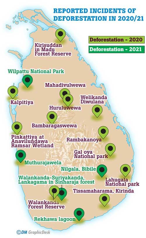 last week. The paddy lands, starting from the boundary of the Park, are fed by the Parakrama Samudra; and they are traditional paddy lands. Out of the 35 farmer organisations 33 of them are against these illegal land grabs. We have already sent our demands to the Divisional Secretariat and the DWC where we have requested the authorities to halt temporary farming practices within the Park. If the land is given away around 20,000 hectares will be destroyed. We already face an aggravated phase of the human-elephant conflict where elephants start roaming in our villages from 4pm on wards every day. By destroying Protected Areas the HEC will intensify,” he further added.
Ongoing satyagraha in Hambantota
29 days have lapsed since a group of farmers in Walsapugala, a village severely affected by HEC in Hambantota, staged a hunger strike demanding the government to Gazette a proposed Elephant Management Reserve (EMR). The Reserve was originally proposed in the 1990s and the farmers believe that allocating a separate reserve for elephants would help control the HEC. In response to the ongoing protest, Irrigation Minister Chamal Rajapaksa has requested a month’s time to Gazette the Reserve.
Farmers in the area are severely affected by the HEC and several of their demands are as follows :
“Elephants are trapped outside the Reserve while illegal practices are taking place within the EMR,” opined Wakadawala Rahula Thera at Centre for Environment and Nature Studies. “There are two hotels and people have drawn water and electricity supplies into the EMR and there’s a mass scale encroachment of lands. The HEC has aggravated to a point where people cannot have hopes about their cultivations anymore. A plan is also underway to release water to people who have acquired Mahaweli lands in the Walawe-Left Bank Mahaweli Development Zone. This will deprive farmers of the water facility. There’s a grassland spanning 2500 hectares, but 600 hectares have been taken up by the highway. Within this area illegal sand mining, stone quarries and other operations take place. Cattle farmers have started releasing their cattle into this area and as a result cattle farmers and paddy farmers are in conflict.” said Rahula Thera.
Several attempts to contact Mahaweli Authority Director General Sunil Perera proved futile.
Proposed developmental plans in Knuckles Conservation Forest
The Knuckles Conservation Forest was declared a UNESCO World Heritage Site in 2010. However, due to failures in demarcating boundaries, especially within the buffer zone, people have found ways of encroaching into this sensitive and critical ecosystem. “Historical accounts prove that the Gombaniya Mountain Range was gazetted as a climatic Conservation area back in 1883,” said Gamini Jayatissa, Convener of the Matale District Environmental Organization and the Executive Director of Grama Abivurdhi Foundation for Environmental Conservation (GAFEC). “It would probably have been the first such conservation area to be declared this way. However the Dumbara Range was subsequently destroyed by the tea plantation introduced during the colonial period. Upon observing the sensitivity of the ecosystem, the DWC, environmentalists and representatives from relevant authorities met to discuss how they could protect the area. This meeting happened in 1988 and by 1994 the Government decided to give away lands that don’t fall into this sensitive area. In 2000, over 17,000 hectares were gazetted as a conservation forest. But even by then around 3000 hectares of private lands still fell within the area. Thereafter the area was regazetted in 2007 with 21 regulations that people should follow provided that they were allowed to carry out limited human activities. Then in 2010 the Knuckles Conservation Forest was a UNESCO World Heritage Site.
“But several issues persist today. Encroachments are taking place within this conservation forest and there’s a lag in bringing these people before the law. The area needs to be protected as it provides 23% of water to the Mahaweli River, 90% of water to by Moragahakanda-Kalu Ganga project. Around 20,000 hectares of state land fall within the buffer zone which has posed a threat to the entire ecosystem. Many of these lands are not being utilised and these lands should be developed to contribute to the surrounding ecosystems. Around 11,000 acres of land in Dumbara and Wasgamuwa Conservation Forest area have been destroyed for developmental purposes.
"“Around 11,000 acres of land in Dumbara and Wasgamuwa Conservation Forest area have been destroyed for developmental purposes. These cleared areas need to be restored and this area within the Knuckles Conservation buffer zone is quite suitable”- Gamini Jayatissa, Convener of the Matale District Environmental Organization"
These cleared areas need to be restored and this area within the Knuckles Conservation buffer zone is quite suitable. Following the Mahaweli Development programme that took place after 1977, many acres of forests were destroyed for development zones posing an irreversible damage to sensitive ecosystems. Even though 17,000 hectares of land were gazetted it has been observed that the actual extend is 35,000 hectares. Therefore, this area needs to be conserved. We propose that the Dumbara Range should be extended up until the Moragahakanda and Victoria-Rantambe reservoirs,” Jayatissa added.
Speaking about several development plans in the pipeline he said that projects such as mini hydro projects would cause further damage to the ecosystem. “Small and large scale hotels are being put up and none of these establishments seem to be concerned about the environment. The traditional villages that fell within the Dumbara Range don’t exist. People with vested interests want to construct roads, but a footpath would be most suitable. Two roads, one from Meemure-Narangamuwa and the other from Meemure-Kiwulewadiya via Dandeni kumbura, Sulugune have been proposed, but we say that these two proposals shouldn’t be continued. It will further affect the conservation area. However these routes could be used as footpaths to even promote tourism. Two roads including Meemure-Hunnasgiriya, Meemure-Rangala routes exist. But if a new route is going to connect Meemure and Knuckles it would only benefit those with vested interests,” he observed.
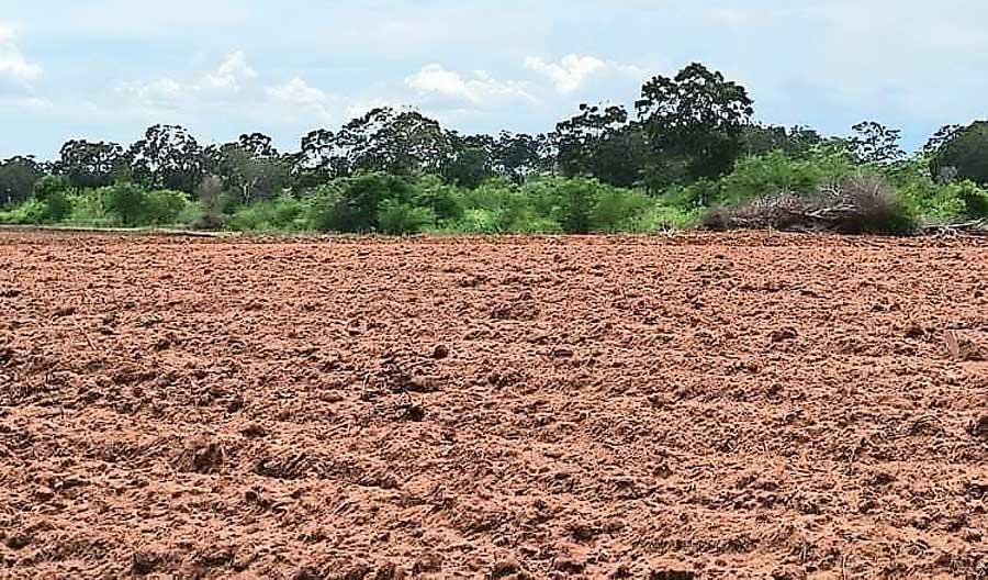
Land clearance in Wandama-Demaliya