Reply To:
Name - Reply Comment

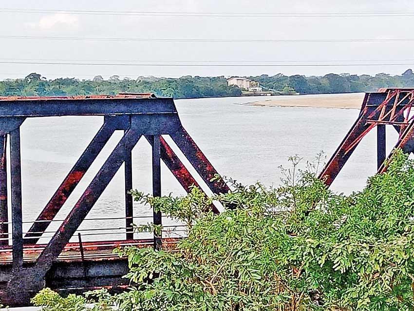
The Manampitiya Old bridge; the site for the second phase of the sand mining project
The DWC has set forward recommendations and conditions to implement the 2nd phase of the Manampitiya sand mining project
A total of 26 sand corridors are to be implemented
Polonnaruwa Forest Range Office has warned that removing sand can hinder movement and habitation of wild elephants
 It is reported that there are plans to hand over new sand mining corridors to remove sand from an area below the Polonnaruwa Manampitiya bridge (the place where the old bridge is located). A letter sent by the Director General of the Department of Wildlife and Conservation (DWC) to the Geological Survey and Mines Bureau (GSMB) confirms this.
The DWC has set forward recommendations and conditions to implement the 2nd phase of the Manampitiya sand mining project. According to those recommendations, a total of 26 sand corridors are to be implemented. The letter states that about 161130 cubes of sand are to be removed.
Manampitiya is home to a floodplains national park. The Mahaweli River overflows during the North East Monsoonal rains. Along with that, many villus- including Handapana, Bendiya, Kokku, Meen, and Chudana- are filled with water. Wildlife and vegetation coexist thanks to that ecosystem”
- Kumarasiri Wijekoon Wildlife Range Officers’ Association President
|
A document being circulated within the Department of Wildlife and Conservation in connection with the second phase of the Manampitiya sand mining project |
The DWC has specified a set of conditions to the GSMB for this project. Among them, the matters relating to wild animals and the reserve are of importance. Accordingly, any kind of waste disposed of at the sand project should not be done in such a way as to harm wild animals. Any tree protected by the Fauna and Flora Protection Ordinance and situated in the project site should not be harmed. Meat of wild animals should not be sold, possessed or served as food. This project should last for a period of one year.
Although the DWC Director General has granted permission for sand mining laying down conditions, the officials of the Polonnaruwa Wildlife Range Office are protesting against such measures. These officials are making a claim that the region is an ecological zone possessing water catchment areas and villus. In a letter addressed to the Director General of DWC, the officials of the Polonnaruwa Forest Range Office have pointed out that removing sand in the area can hinder the movement and habitation of wild elephants. They also pointed out that threats posed by elephants to nearby villages may increase unexpectedly. Sand removal takes place in an area of 6 km on both sides of the river; in the upper part of Manampitiya bridge. However the area below the bridge is often used by elephants for movement and habitation.
Letters are also being exchanged these days requesting permission for sand mining in Somavathiya area as well. Commenting on this issue, Wildlife Range Officers’ Association President Kumarasiri Wijekoon said that the talked about issue would lead to serious environmental destruction. “Manampitiya is home to a floodplains national park. The Mahaweli River overflows during the North East Monsoonal rains. Along with that, many villus- including Handapana, Bendiya, Kokku, Meen, and Chudana- are filled with water. Wildlife and vegetation coexist thanks to that ecosystem. Grasslands form when villus dry out. That grass on these grasslands provides elephants and elk with the solid food they need.

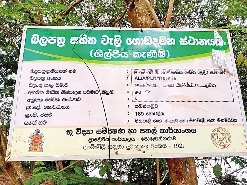
A billboard put up at the Manampitiya sand mining project site suggests that sand mining is done with permission
The DWC officers objected to it. Therefore, we have not received any information in this regard. If it is reported that sand mining will have an impact on the area that supplies drinking water then no permission will be given to extract sand”
- W.A. Dharmasiri Polonnaruwa District Secretary
But now the lower part of the Manampitiya bridge is to be allocated for sand mining; citing that floods are occurring in this area. Authorities are yet to understand that this area is known as a floodplain. Kaduruwela or Manampitiya will not be inundated when there are flood due to the presence of this floodplain,” said Wijekoon who added that due to this natural geographical set-up only the reserve will be affected in the face of a flood.
But now this natural system is exposed to the risk of destruction given there are plans to mine sand in the lower part of the Manampitiya bridge. Wijekoon said that DWC officials- including himself-do not approve of this sand mining project.
People in this area said that the drinking water for Polonnaruwa is supplied from the area in the Mahaweli River where the lower part of the Manampitiya Bridge is situated. They said that if this sand project commences there will be a problem in supplying water to Polonnaruwa. When inquired a spokesperson of the Polonnaruwa National Water Supply and Drainage Board said that more than 2000 families benefit from the water supply in the Manampitiya area. He also said that the water requirement of more than 15,000 people are met with at present. Manampitiya Station Officer of the National Water Supply and Drainage Board Piyal Ranjana said that he was not aware of sand mining activities in the area, where water is obtained from. Ranjana said, “I cannot explain in a few words the damage caused by mining sand in this manner. I will explain this matter in detail later”. He obtained the telephone number of this writer. While penning this article, this writer called Ranjana several times, but he hung up saying that he would reveal details later. There was no answer from him till this edition went to press.
When issuing mining permits we do it with the involvement of the Ministry of Wildlife and Forest Resources Conservation and the Central Environment Authority. We are investigating whether it will cause a problem for the Polonnaruwa Water Supply Board”
-Kushan Gunasekara Senior Director (Excavation) of the Geological Survey and Mines Bureau
The Daily Mirror also inquired about this issue from Polonnaruwa District Secretary W.A. Dharmasiri. He said that there is an ongoing discussion. “The DWC officers objected to it. Therefore, we have not received any information in this regard. If it is reported that sand mining will have an impact on the area that supplies drinking water then no permission will be given to extract sand. That place will be protected as long as the DWC does not allow sand mining activities,” he added.
Attempts made to contact the Director General of DWC proved futile. An authority there connected this writer to an officer who was said to be in charge of protecting fauna. He said that no action has been taken regarding sand mining and connected us with the publicity division. There were doubts whether his behaviour suggested it was his form of protesting against our questioning.

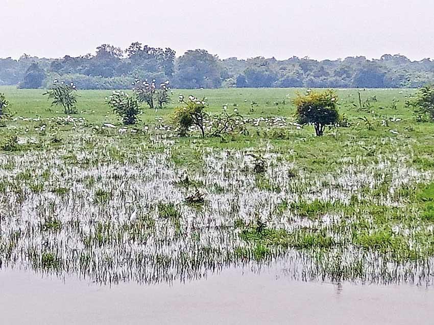
Manampitiya has so far not been inundated when there are floods due to the presence of floodplains shown in the picture
Kushan Gunasekara, Senior Director (Excavation) of the Geological Survey and Mines Bureau said the following: “There is no final decision regarding this sand mining project. Information regarding the issuing of these licences reaches the Director General. He is looking into it. When issuing mining permits we do it with the involvement of the Ministry of Wildlife and Forest Resources Conservation and the Central Environment Authority. We are investigating whether it will cause a problem for the Polonnaruwa Water Supply Board. We are working together with the relevant institutions to resolve the preliminary investigations without any problem. By now, the Polonnaruwa office and the Director General may have received applications for mining permits. They will be working on them.” he added.
When this newspaper made inquiries regarding this issue from the Central Environment Authority officials there said that nothing has been reported about the Manampitiya sand project.