Reply To:
Name - Reply Comment
South-east Australia is collectively shivering through a prolonged spell of bleak wintry weather — a pattern that will linger for at least another week.
Yesterday was so cold in parts of south-west New South Wales and Victoria that a handful of locations shivered to their lowest maximum in years, including Melbourne where the high only reached 10.1 degrees Celsius, the city's coldest day in five years.
It was even colder in the NSW Riverina where Griffith only managed a top of 9.2C, 6 below average and the town's lowest maximum in eight years.
Temperatures today will again remain below average across many regions, with the most extreme anomalies under thick cloud and rain from south-east SA, through western and central Victoria to southern NSW.
Like yesterday, a handful of towns today could record their lowest maximum in years, struggling to even reach double digits.
What is uncharacteristic about the current cold spell, is the usual culprit — strong fronts and polar blasts from Antarctica — are absent from the weather map.
So why are temperatures so low? Occasionally the coldest days in Australia result from cloudy skies and light winds, without an injection of very cold air from the south.
During these spells of calm, gloomy weather, cloud blocks out the sun — a fairly self-explanatory process that prevents heating, however, the other key factor, the lack of wind, also plays a role by preventing warmer air from transferring in from surrounding regions.
Basically, cold air becomes isolated near the surface.
The effect is enhanced further when rain is falling as the partial evaporation of drops (or the melting of snowflakes up near the clouds) also lowers the air temperature.
This scenario is more difficult to forecast than a regular cold snap because even the shortest spell of sunshine or stronger winds will cause the temperature to briefly spike, leading to a conservative forecasting.
This process was clearly evident across Melbourne on Thursday — after a relatively mild overnight low of 8.3C, the city spent the day under cloud and drizzle, leading to only a two-degree increase in the temperature, and a maximum well below the forecast of 13C.
Melbourne Airport's maximum yesterday was even chillier at 9.7C, its coldest day in three years.
Cold weather will continue across south-east Australia on Saturday, particularly through eastern NSW under the thickest cloud and heaviest rain, however, slightly more sunshine elsewhere should confine single-digit maximums to Tasmania and the Great Dividing Range.
Temperatures will remain slightly below average on Sunday, however just as days become a touch warmer, overnight temperatures will plummet, as the clearer skies allow surface heat to efficiently radiate into space at night.
Through early next week, much of the south-east will wake to temperatures near freezing, and along the ranges minimums should plunge to around negative five.
The cloud is not just dropping temperatures, but also rain, and fortunately it's landing over regions that missed out earlier this month.
The heaviest falls today will stretch from Adelaide to the Mallee and Wimmera, where an average total of around 5mm to 15mm should accumulate by midnight.
The most intense rain will shift to eastern NSW on Friday night and produce 20mm to 40mm from Forster to the Illawarra by late Saturday, including across Sydney's east.
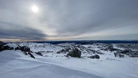
Despite the chilly weather, no significant snow will fall across the Alps through the coming days as the rainband drifts just to the north of our ski resorts, however, the cold weather will preserve the current snow cover and allow for overnight snowmaking.
The next dump of natural snow should arrive across alpine resorts around Thursday next week. (ABC News)