Reply To:
Name - Reply Comment
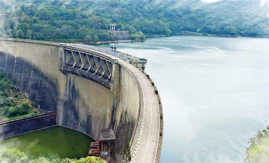
Victoria Dam (Pix by Samantha Perera)
- According to experts those tremors were a result of limestone quarrying
- Drilling for a long time to extract limestone creates cracks causing the areas to collapse due to water pressure
- There is a crack towards the eastern slope of the Mahaweli River which experts opine should be geologically investigated
- None of these tremors has caused any damage to the reservoir or the dam yet
- Block nine of the dam has a crack which has existed since its construction and it is being observed using 3D equipment
- A committee is expected to conduct a study on Victoria, Randenigala and Rantabe dams
- According to data present, a change in soil layers in the interior of the earth was the cause behind tremors
Commenting on earth tremors in Digana, Anuragama, Alutwatta, Haragama, Talatu Oya, Gurudeniya, Sinharagama, Mailapitiya and Kundasale on August 28, 2020, locals said that they heard a booming sound and their roofs and glasses were rattled. “We felt as if something was moving underground and walls cracked. We were frightened. We could have been prepared if we knew what was happening. We were worried that the Mahaweli river which is beyond this mountain would overflow,” they added.
Sri Lankans have not experienced earthquakes and are unaware of how to confront one. They had no experience about a Tsunami until the disaster struck on December 26, 2004. Most people who went to witness the disaster had to pay with their lives. Some people knew about the Tsunami from the story of Viharamaha Devi. Kelani Tissa, the King of Kelaniya murdered an innocent monk by putting him in a cauldron filled with boiling oil. Seeing this misdeed, the God became furious and sent sea waves inland. The king listened to the scholars and sacrificed his  daughter to the sea to avert the destruction. The act of sacrifice is said to have calmed the sea. People who only heard of this story went to see the destruction and eventually lost their lives.
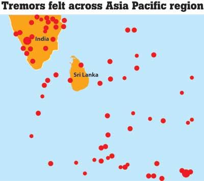
A series of earth tremors have affected Sri Lanka recently. Geological Survey and Mines Bureau is investigating the reasons behind such tremors including the ones in Victoria, Digana and Kundasale from 28 August 2020.
Nine tremors have been felt in the areas within four months from August 28. On 07 December 2020, Senior Geologist of Geological Survey and Mines Bureau (GSMB) Mahinda Senevirathne confirmed to the media that seven of them were recorded in Bureau’s seismographs.
The attention of everyone was on the tremors reported since August as the Mahaweli is located nearby and the question arose whether these tremors might have an effect on the river dam. Randenigala and Rantabe reservoirs are located below the dam. If an earth tremor affects the Victoria reservoir, will the said reservoirs be able to retain the amount of water? According to the Mahaweli Authority, people from Ampara, Dimbulagala, Dehiattakandiya, Giradurukotte and Mahiyangana
will have to suffer its consequences.
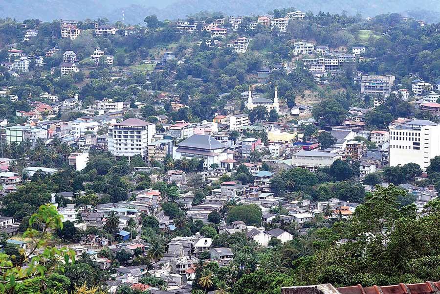
Kandy City
Director of Major Dams and Reservoirs Operation of Mahaweli Authority, S. R. K. Arukwatte said that if a large earthquake occurred, such destruction could be predicted. “So far there is no such risk. Reservoir dams under the Mahaweli Project are earthquake-resistant constructions. There will not be any damage to the Victoria dam or its acceleration or concrete structure. Seismographs were placed in major dams in Sri Lanka by 2015 World Bank funds and they record even the slightest tremors near dams. Our seismographs recorded those which were not recorded in the seismographs of the GSMB. According to them, those tremors were a result of limestone quarrying. If these earthquakes continued, weak soil layers might sink. Drilling for a long time to extract limestone creates cracks causing the areas to collapse due to water pressure. These cracks may deepen later, or large cavities may cause leaks. However, the dam is strengthened using a 300 metre layer of concrete. The GSMB is currently studying these earth tremors,” he added.
Deputy Director of the Victoria Reservoir Wasantha Ahalapitiya said that the very first tremor was recorded in the seismographs in the reservoir enabling to find its Richter scale. “The gravitational acceleration of seismographs in the dam and on both sides is measured with the value of G. Converting the data obtained to Richter scale was a problem and therefore we dispatched our civil engineers to study at state institutions. But those institutions did not teach them about those conversions. These seismographs are placed to detect tremors in the Vitoria Dam and to see whether they cause damage or impact the acceleration of the dam. None of these tremors has caused any damage to the reservoir or the dam yet.
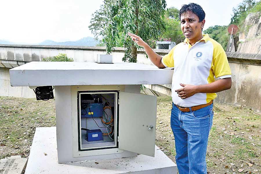
Civil Engineer D,M,S.S Siripala explains how tremors are recorded in the seismograph
Causes for tremors
The GSMB said that limestone quarries and drilling activities caused these tremors. As many parties said that our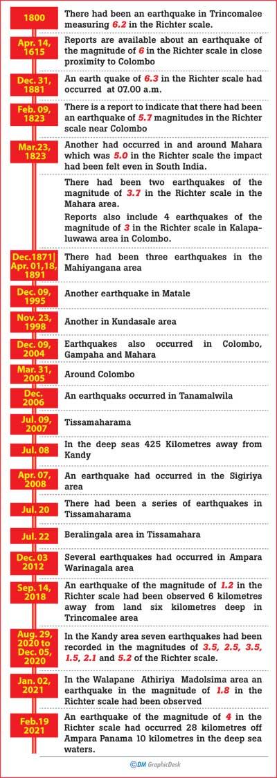 seismographs record even the slightest surface level tremors, we conducted another analysis for the protection of the dam. We conducted drilling activities similar to limestone quarrying 5-6 kilometres away from the dam towards Digana. None of the tremors were recorded in the seismographs. It was clear that the tremors therefore occurred deep inside.
There is a crack towards the eastern slope of the Mahaweli River and that should be geologically investigated. The tremors were recorded as 0.01 G in seismographs and the Richter scale was 3.5. The Victoria Dam is constructed to resist a gravity of 0.1 G and if an object moved in a higher gravity, the dam could burst. The gravity of earth is 1.0 G. The dam’s gravity in Richter scale is 6- 7. Such magnitude can crack the dam and whether it can break the dam is unpredictable.
The whole river does not consist of limestone and they are located deep underneath. We have plans and we want to ensure the safety of the dam. Block nine of the dam has a crack which has existed since its construction and it is being observed using 3D equipment. These tremors have not affected that crack. Through a committee appointed by Mahaweli Director General and with the participation of Engineering Faculty of Peradeniya University, an investigation will be conducted to study Victoria, Randenigala, and Rantabe dams’, Ehalapitiya added.
Senior Professor of the Department of Geology, University of Peradeniya Prof. Atula Senaratne who is studying the tremors said that they have occurred due to limestone explosions and the impact of Metamorphic limestone inside the earth. ‘On the instructions of the Minister of Environment Mahinda Amaraweera an expert committee was appointed to conduct a study. I cannot comment further as its results have not been released to the media yet. I haven’t studied any reports of the study conducted by Professor Wilbert Kehelpannala. I cannot say more as I am already in the committee,” Senaratne added.
However, on April 18, 2016 Prof. Atula Senaratne said (On Sirasa news) that earth tremors in Pacific and Indonesian zones run back to 200 years. ‘Sri Lanka is located in the centre of the Indian Plate which does not experience earth tremors,” he added.
So far there is no such risk. Reservoir dams under the Mahaweli Project are earthquake-resistant constructions. There will not be any damage to the Victoria dam or its acceleration or concrete structure. Seismographs were placed in major dams in Sri Lanka by 2015 World Bank funds and they record even the slightest tremors near dams - Director of Major Dams and Reservoirs Operation of Mahaweli Authority, S. R. K. Arukwatta
 Commenting on tremors in Kandy on December 6, 2020 (Sirasa news) Prof. Senaratne said that he could not ensure that the present incidents might not repeat in future. He also added that reservoirs constructed in areas not experiencing tremors are constructed to resist tremors of 3.5 in the Richter scale or above magnitude and a proper conclusion could be arrived at from studies done by Geologists.
Seneviratne said on December 7, 2020 that the seven tremors that occurred starting with the first one on August 29 were recorded in GSMB seismographs and were minor ones.
GSMB Senior Geologist Nilmini Thaldena told the media on December 7, 2020 that only seven tremors were recorded in GSMB seismographs because they were different from those used in the Victoria Dam. “Causes for such tremors could be human activities including explosions and weapon use, pressure between natural Plate boundaries, and change in water level. Therefore each phenomena would be considered separately. According to data present, a change in soil layers in the interior of the earth was the cause behind tremors. Geological structure based on the direction of seismic waves has caused these tremors. Limestones were located 2-3 kilometres deep and as waves do not travel far, such tremors are not recorded in seismographs in Mahakandarawa centre,” she added.
The Victoria Dam is constructed to resist a gravity of 0.1 G and if an object moved in a higher gravity, the dam could burst. The gravity of earth is 1.0 G. The dam’s gravity in Richter scale is 6- 7. Such magnitude cancrack the dam and whether it can break the dam is unpredictable - Deputy Director of the Victoria Reservoir Wasantha Ehalapitiya
According to Geologists, a release of soil layer in the Victoria Reservoir has caused the nine tremors. There is a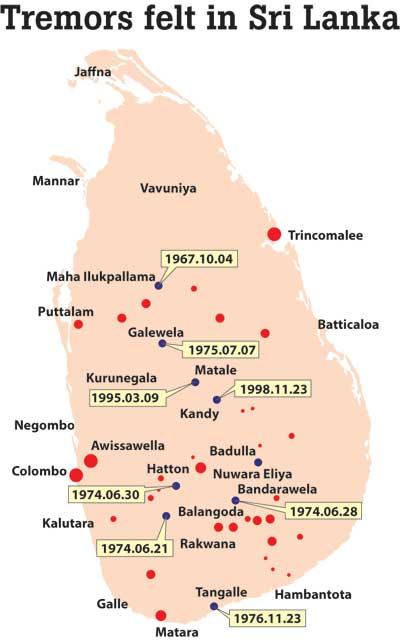 layer of limestone in the reservoir basin and water accumulated for 30 years has caused limestone to dissolve and create cavities which might collapse. They showed that similar incidents happen in other countries as well and a large tremor could occur at an unexpected time.
The report handed over by the expert committee appointed by Mahinda Samaraweera on November 24, 2020 revealed that dolomite mining, dynamite explosions, changes of natural plates, natural collapsing of rocks, change of water level in Victoria reservoir caused the tremors. Huge dynamite explosions had been reported in the area.
The report recommended further scientific studies to be conducted regarding tremors. Directing a geological group to prepare a structural plan of the area and to conduct a geological study, conducting a continuous study for a long time, studying on the structured cracks related to dolomite deposits in Alutwatta and giving a distance education to students and selected individuals in the area to report incidents were other recommendations of the report.
The Chairman of Geological Survey and Mines Bureau, Eng. Anura Walpola said that investigations are conducted thoroughly in connection with this incident. ‘We often obtain assistance from Professors overseas via Zoom. As there are rains in April we might face obstacles. Such incidents have reoccurred in previous years in April. The expert committee has recommended that minor tremors do not cause any damage. We have focused greatly on Victoria, Randenigala and Rantabe reservoir dams which are resistant to tremors of more than 3.5 – 4 magnitude. Therefore there won’t be any issues, he added.
"I could not ensure that the present incidents might not repeat in future. The reservoirs constructed in areas not experiencing tremors are constructed to resist tremors of 3.5 in the Richter scale or above magnitude - Senior Professor of the Department of Geology, University of Peradeniya Prof. Atula Senaratne"
Mahinda Amaraweera said that based on the recommendations of an expert committee a group of officers of GSMB are stationed in the area and are carrying out thorough studies and examining activities in the area. So far there is no earthquake risk, he added.