Reply To:
Name - Reply Comment
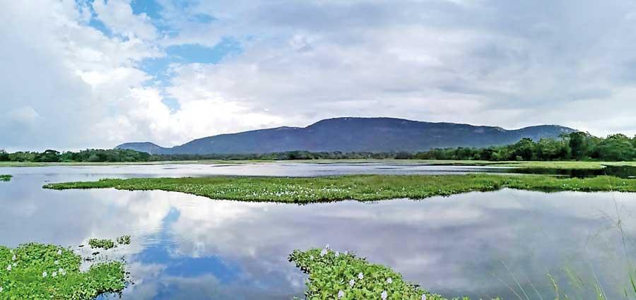
The Galgiriya mountain seen from afar
- It is accepted that Prince Saliya married Ashokamala and came to live in the Galgiriya Mountain
- The Galgiriya Mountain is now a sacred place of worship for forest dwelling monks
- The sacred site at The Galgiriya Mountain was discovered in 1962 by Arahapola Vipassi Thera
- Approximately 60-70 acres of the forest belongs to this forest monastery, which comprises of more than 20 rock caves
- At present this forest monastery has been registered with the Archaeology Department
- The other special feature of the Galgiriya Mountain is the presence of two tanks on top of the mountain
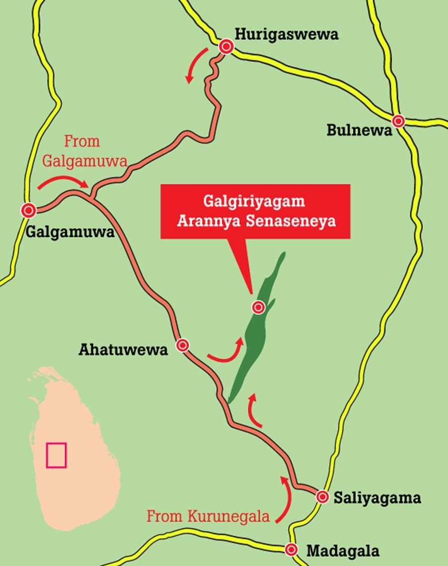
The 11 km long Galgiriya Mountain is known as the longest mountain in Sri Lanka. The mountain is situated in the Ahatuwewa Divisional Secretariat of the Galgamuwa Seat and comes under the purview of the Kurunegala District. There are many folk tales associated with this mountain.
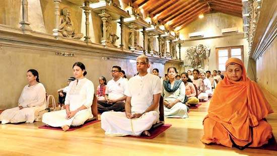
In particular, the story of Saliya and Ashokamala unfolds based on the Galgiriya Mountain. Historically, it is accepted that Prince Saliya, the son of King Dutugemunu, married Ashokamala and came to live in the Galgiriya Mountain. Numerous proofs and pieces of evidence supporting this history can still be found on the Galgiriya Mountain even at present. The Galgiriya Mountain, once considered the land where the love story of Saliya and Ashokamala unfolded, is now a sacred place of worship for Aranya Senasana monks (forest dwelling monks), practising meditation. Historical records confirm that Prince Saliya ruled this area as a local leader and constructed tanks and anicuts to promote agriculture. Anyone visiting the area today can witness the agricultural revival that originated from his efforts.
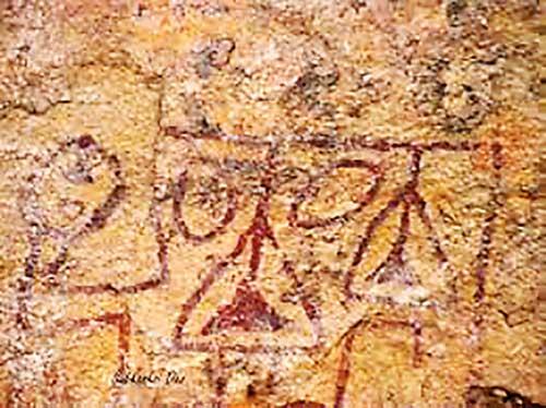
The Galgiriya Mountain is the native land of Prince Saliya, who, as a local ruler, made this area very prosperous. The rock caves testify that Arahath Theras (Enlightened monks) lived on
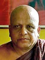
|
Sumedha Thera |
this mountain. Cauldrons are carved in these rock caves while stone inscriptions also confirm that enlightened monks lived in this large forest. The sacred site at The Galgiriya Mountain, with a rich heritage, was discovered in 1962 by Arahapola Vipassi Thera. Until then, this area was covered by dense jungle. Vipassi Thera arrived at this place and spent his time in meditating. Later, other monks arrived and started practicing meditation. Since then, this place has become an Aranya Senasana (forest monastery). At present, about 12 monks reside in the Aranya Senasana of Galgiriya Mountain doing meditation. Approximately 60-70 acres belong to this forest monastery, which comprises of more than 20 rock caves. There are four main stone inscriptions in this area although most of them have already been destroyed and the inscriptions have been erased. Additionally, there are inscriptions in the rock caves indicating that enlightened monks lived in this place in the past. The stone inscriptions and cave inscriptions mention that Prince Saliya offered this mountain and stone caves to Pussadeva Arahath Thera. At present this forest monastery has been registered with the Archaeology Department. While a study has been conducted on its stone inscriptions and cave inscriptions, no other research has been undertaken, according to Galgiriya Kanda Aranya Senadhipathi, Vitharanagama Sumedha Thera.
This area also features the most successful tank cascade system in Sath Korala, based on the Galgiriya Mountain. With the water springs originating from the Galgiriya Mountain, around four hundred and twenty tanks in the area have been continuously fed until today. Folklore researcher Karunaratne Mahagamarala said that the water from the Galgiriya Mountain travels all the way to the Tabbowa Reservoir.
The other special feature of the Galgiriya Mountain is the presence of two tanks on top of the mountain; a feature that no other mountain in the island nation can match. Both tanks are believed to have been built by Prince Saliya. The first tank on this mountain is Ahas Wewa, located near Maligathenna. The second tank is built across the place where water from Ahas Wewa resurfaces.
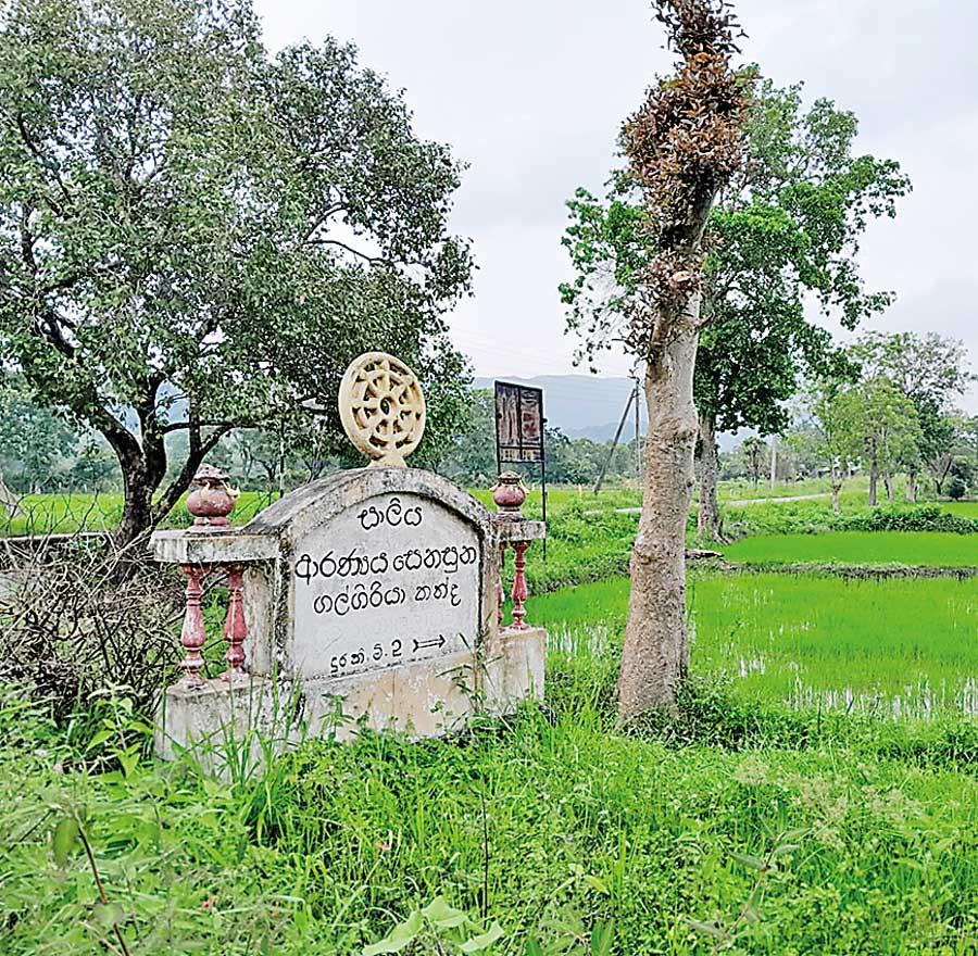
A name board indicating the presence of a forest monastery
Mahagamarala said that the tank is called Nagaha Wewa because it is situated in the midst of a group of Na trees.
After that, Prince Saliya built another tank known as Matigathpathaha. The tank is named Matigathpathaha because Prince Saliya constructed it in the area where he obtained clay to build the defencive wall of his territory. The tank is no longer visible today, as it was destroyed after the Kalinga Magha invasion. At the tank’s location, a diagram containing the images of seven snake heads is engraved on a stone. There is a belief that a treasure is hidden there; with seven baskets of gems concealed within the seven heads.
However, no one has been able to retrieve the treasure, and several individuals who attempted this task earlier reportedly died on the spot. Prince Saliya then constructed Ulpatha Wewa. Mahagamarala said “There is reference to this information in the book ‘Kadayim Saha Viththi’. Prince Saliya didn’t arrive at the Galgiriya Mountain at once. After marrying Ashokamala, Prince Saliya searched for a safe place to live. He then saw a big mountain close to Anuradhapura and visited this area with a person named Aritta in search of that mountain. When climbing to the top of this mountain one can clearly see the pinnacle of Ruwanmali Seya”.
According to Mahagamarala the book titled “Sinhala Vasthupakaranaya” book makes references to when Prince Saliya visited this area. He had had a desire to make Galgiriya Mountain a prosperous place and together with Ashokamala he came to this area secretly.
When Prince Saliya and Ashokamala came to live in this area, relatives of Ashokamala too arrived fearing that King Dutugemunu might cause them trouble. According to Mahagamarala descendants of that generation still live in a village called Lokurugama. Large temple trees can also be seen on this mountain. There had been a garden of temple trees; also known as Ashoka Forest. Those who provided weapons to Prince Saliya are settled in Achirigama. The descendants of that generation still exist. In that village, tools used to make weapons and iron smelters can be seen even today.
After Prince Saliya arrived at Galgiriya Mountain, King Dutugemunu wanted to know where Prince Saliya was. Mahagamarala said that according to legend Prince Saliya’s whereabouts were discovered with the aid of a spy.
“There is reference to this information in the book ‘Kadayim Saha Viththi’. Prince Saliya didn’t arrive at the Galgiriya Mountain at once. After marrying Ashokamala, Prince Saliya searched for a safe place to live. He then saw a big mountain close to Anuradhapura and visited this area with a person named Aritta in search of that mountain. When climbing to the top of this mountain one can clearly see the pinnacle of Ruwanmali Seya
- Karunaratne Mahagamarala Folklore Researcher
King Dutugemunu had sent treasures packed in fourteen horse carts after learning that Prince Saliya was living on Galgiriya Mountain. According to folklore, his intention was to give the treasure to Ashokamala and her relatives and make Prince Saliya return to Anuradhapura. However, Prince Saliya rejected it and sent a message to King Dutugemunu, stating that he would not abandon Ashokamala even if the entire treasure of Sri Lanka was given to him. Nevertheless, King Dutugemunu instructed not to return the treasure and to present it to Prince Saliya. According to Mahagamarala that wealth was used by Prince Saliya to establish the irrigation industry in and around Galgiriya Mountain.
Saliya and Ashokamala resided in the Maligathenna area on Galgiriya Mountain. Ashokamala observed a lotus flower blooming on a rock far away from that place. Subsequently, upon
|
A letter on a stone cave |
searching for the location of the lotus flower, it was discovered that it bloomed in a small pond between two boulders. Ashokamala proposed to build a tank there. This place was in the close proximity to where elephants, brought to be used in construction work of tanks, were sstationed. The ground in that area had been reinforced with strong bricks. The tank built there is known as Ranpathwila. It is also known as Adara Wewa because Saliya built this tank to cater to Ashokamala’s request. This place is also known as Gale Wewa. Moreover, this tank is filled with the overflowing water from around sixty anicuts nearby. There is also an opinion that this lake is called Gale Lake because it is filled with water from many anicuts. The size of this tank is about 800 acres. Mahagale paddy field is located below that tank.
Mahagamarala said that even today, when you dig six feet deep in the tank, you can see the bricks of the elephant barns and its ruins.
Prince Saliya efficiently utilised the water from Mahagale Wewa for farming purposes without putting it to waste. The water was secured by building the Paskolavetiya anicut. From there the water was transferred to Hunugallewa, Ambakolewa and Atharagalla after constructing Thimbiri Pokuna Wewa. However, the anicut is now destroyed. This tank was destroyed during the construction of the railway during the British period. Additionally, there is a large 15-acre paddy storage complex built by Prince Saliya using stone pillars; which is known as the Gal Kanu Yaya. A moonstone is also present at the site. Mahagamarala added that the place has been vandalised by treasure hunters.
A tunnel is located in Galgiriya Mountain and it measures about eight feet in height. After approximately 20 metres along the tunnel there are descending steps. The tunnel continues from there. Currently, a large stream flows down this tunnel. No archaeological excavation has been conducted on this tunnel yet. However, according to folklore, it is said that this tunnel stretches to Rajanganaya. It is also believed that Prince Saliya built this tunnel.
King Dutugemunu was unsettled when Prince Saliya left the royal palace after marrying Ashokamala. However, King Dutugemunu could not maintain a close relationship with Prince Saliya due to the potential that existed of criticism being aimed at him if he maintained relations with a family belonging to a lower caste. According to legend, when King Dutugemunu informed Saliya that he wanted to meet him, Saliya suggested building a tunnel near Anuradhapura, so that he could use it to come and meet the king. It is said that this tunnel was built thereafter and that it extended to Rajanganaya. A section believed to be part of this tunnel can be seen near Mailawa Wewa. The tunnel has been built by drilling through a layer of the rock beneath the ground.
According to Mahagamarala, the people of that area claim that this tunnel also leads to Rajanganaya.
Legend has it that the name Rajanganaya came to being because of the courtyard where King Dutugemunu and Prince Saliya met. There is a school of thought that the names Raja Anganaya were later joined and used as Rajanganaya. Mahagamarala said that many villages in the Rajanganaya area are named Saliya Pura, Saliya Weva Handiya, Saliya Ashokapura.