Rubber has been grown traditionally in the Low Country Wet Zone covering the Southwestern, Southern and Central parts of Sri Lanka, though the low and mid elevations in the Intermediate and Dry Zones are also being explored now with varying degrees of success. This tract is however, now reaching a level of saturation for rubber cultivation and the scope of further expansion is very much limited. Therefore, it has become necessary to look for new locations to plant rubber.
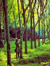
Land use planning
Allocation of land for tree crop agriculture in Sri Lanka has hitherto been based on ‘adhoc’ considerations. The over-riding approach has been to allocate the least productive soils to various forms of plantation agriculture. Furthermore, even the current allocation of land for tree crop plantations is made mainly on the basis of climate or geographic region with no recognition given to the occurrence of different kinds of soils within a particular region.
Some very striking and significant soil-vegetation relationships have been observed and described, especially in the dry and Intermediate Zones of this country by several field scientists and researchers engaged in the Soil Survey of Sri Lanka since the early 1960s. In several recorded instances it has been observed that the nature of soil exerts a profound influence on the growth and performance of plantation crops.
Soil related factors should, therefore, be considered as having a very important bearing on crop performance and crop productivity on different kinds of soils occurring within the same agro-ecological region. Meaningful land use planning for plantation agriculture, therefore, should be based on a proper understanding of the soil-vegetation relationships.
Also, as soil makes the major part of the environment, information on soils becomes an essential need in environmental conservation strategies. With this context, the Soil Science Society of Sri Lanka initiated a twinning project with the Canadian Society of Soil Science to characterize and document in detail information on soils of Sri Lanka, a process initiated when I was the President of the Soil Science Society of Sri Lanka.
As the Government of Sri Lanka (GOSL) and the rubber industry are very keen to extend rubber growing to new locations where land and labour are expected to be non-limiting factors, the objective of this article is to summarize the findings of this project specifically for the benefit of the rubber industry, which intends moving into new locations for their raw material.
Intermediate Zone
The Intermediate Zone of Sri Lanka is the area sandwiched between the Wet and Dry Zones receiving a mean annual rainfall of 1750 to 2500 mm. This covers an area of about 1.2 million ha of the country. As the climatic conditions change through a wide range, the Intermediate Zone consists of 20 Agro-Ecological Regions (AER) and sub regions.
This climatic variation is reflected in the soils, where 40 benchmark soils were characterized. Apart from its great diversity, it consists of highly productive Agro-Ecological Regions as up country and mid country Intermediate Zone.
The climate
The dynamics of the atmosphere is extremely variable over Sri Lanka due to its location near the equator and the influence of the monsoonal circulation over south Asia. Subsequently, the climate of Sri Lanka, particularly rainfall, varies strikingly both over different space and time scales. Moreover, the presence of a central mountainous region with a peak elevation of 2,524 m has a major effect on the climate of various regions and produces much sharper climatic contrast between southwestern quadrant and the rest of the island.
Regionality of the rainfall distribution in Sri Lanka has traditionally been generalized in terms of a ‘Wet Zone’ in the Southwestern region including the central hill country and as the ‘Dry Zone’ covering the rest of the country. However, it would be unrealistic to look for a sharp or linear boundary line between these two zones.
Hence, it should rather be regarded as being separated by an ‘Intermediate Zone’ of transition occurring in the central hill country except in the south and the west. The Intermediate Zone demarcates the area, which receives a mean annual rainfall over between 1,750 to 2,500 mm with a short and less prominent dry season. This climatic factor, therefore, appears to be acceptable for growing rubber in the absence of new land in the ‘Wet Zone’. Nevertheless, in some years, the rainfall regime of the ‘Intermediate Zone’ could represent either Wet Zone or Dry Zone characteristics depending on the state of the General Circulation of the atmosphere.
The genesis of soils from parent material greatly differs according to the climatic conditions and therefore, proper understanding of it is needed.
The selected distinguishing characteristics of the different Agro-Ecological Regions, which is presently used as the unit for land use planning in the country, should also be considered in planning the new locations for growing rubber.
The variation of the topography is another reason for the occurrence of many different soils in the Intermediate Zone of Sri Lanka, which is linked to the physiography and landform that decide on the main land systems in the area.
Land systems of the Low country, Mid country and Up country Intermediate Zone have been identified using topographic and remote sensing maps published by the Survey Department. A total of 36 land systems in the Intermediate Zone have been identified.
Characterization of soils
The Intermediate Zone soil database consists of the soils of the Low country (0-300 elevation), Mid country (300-900m) and Up country (900m) Intermediate Zone. A total of 40 benchmark soils have been identified from these areas. Soil units are normally identified by field reconnaissance using auger holes and observations from road cuts and construction sites.
From these, the soil series are identified according to the morphological characteristics and distribution. A soil series shows the same sequence of genetic horizons (layers) and is derived from similar parent material.
When the soil series are named, names already established by previous workers and in use are reconsidered first. Any new soil series is named according to the area these were first identified (e.g. Bibile series) or a special character in the soil as poor drainage (e.g. Wagura series).
Once the soil series are identified, a benchmark location from each series is selected for detail characterization. These locations are geo-referenced using a Geographical Positioning System (GPS).
This facilitates identifying the location accurately for any future planning and in characterizing the changes taken place after many years. Geo-referencing also makes the database useful for any professional using tools as Geographical Information Systems (GIS) for mapping soil or related features in the areas selected for planting rubber in this new location.
Each benchmark site characterizes in detail the landscape features, parent material, drainage conditions, erosion states etc. Soil pits are dug for identification of the major soil horizons. Soil physical and chemical parameters are characterized for all horizons using accepted standard methods. This information consists of the database and is used to classify the soils according to international methods as Soil Taxonomy and FAO/UNESCO method.
The data collected have been compiled as a digital database and can be used for many different applications as in land use planning for agriculture, and in our case for planting rubber. The distribution of soil series of the Intermediate Zone has been mapped at a scale of 1:400,000.
Risks and limitations
Nevertheless, there are some risks and limitations in using the soils of the Intermediate Zone for planting rubber. The soils of the Intermediate Zone exhibit a wide variation of topographies and are not intensively weathered as the Wet Zone soils.
Therefore, they are not excessively leached and comparatively richer in plant nutrients. Using the database available, each soil series can be evaluated for major physical limitations as shallow depth, low available water, poor aeration, susceptibility to erosion and flooding and chemical limitations as high acidity, iron toxicity and low nutrient availability.
Additionally, some areas consist of natural and plantation forests. The management practices that should be adopted to overcome the risk and limitations should be addressed in order to obtain higher yields from cultivated rubber.
As an example, for each series where rubber is grown, the amount of fertilizers that should be added, the mulching requirements and establishment of composting pits, maintenance of cover crops and feasibility of using drip irrigation etc. should be considered.
As rubber is normally grown at elevations less than 500 m, the up country Intermediate Zone covering the regions IU1,IU2 and IU3 are expected to be excluded from considering for rubber planting, except the Badulla region at an elevation of about 670 m, as some un-economical tea lands have already gone into rubber in this region.