-
Three independent satellites find that almost the entire ice cover has seen melting at the surface this month
-
Melting has spread rapidly, from affecting 40 per cent of the ice sheet to 97 per cent within a week
-
It comes as Greenland sees unusual 'heat dome' weather patterns
Scientists have raised fears of rising sea levels after pictures showed Greenland's ice sheet has melted over a larger area than at any time in more than 30 years of satellite observations.
Almost the entire ice cover of Greenland has experienced some melting at its surface this month, according to data collected by three independent satellites.
The findings, described as 'unprecedented' by NASA, have stunned scientists, who say only about half of the ice sheet melts naturally during an average summer.

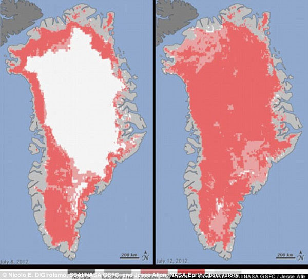
Unprecedented: These maps show the extent of surface melt over Greenland's ice sheet on July 8 (left) and July 12 (right)
One expert even suspected that the satellites had made a mistake at first, so surprising were the results.
Son Nghiem, of NASA's Jet Propulsion Laboratory in Pasadena, California, was analysing radar data from the Indian Space Research Organisation's (ISRO) Oceansat-2 satellite last week when he noticed that most of Greenland appeared to have undergone surface melting.
He said: 'This was so extraordinary that at first I questioned the result - was this real or was it due to a data error?'
Mr Nghiem checked the Oceansat-2's findings against pictures taken by other satellites, belonging to NASA and the US Air Force.
Scientists found that the melting had spread quickly - from about 40 per cent of the ice sheet on July 8 to about 97 per cent four days later.
NASA has released colour-coded maps showing the dramatic change between July 8 and July 12.
Areas in dark pink show where two or three satellites found evidence of melting. Areas in light pink show where one satellite found evidence of melting.
Greenland has seen an unusual weather pattern since the end of May.
The extreme melting coincided with the last of a series of strong ridges of warm air, described by NASA as 'heat domes'.
Thomas Mote, a climatologist at the University of Georgia, said: 'Each successive ridge has been stronger than the previous one.'
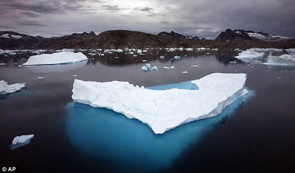
 Concerning: Icebergs float in a bay off Ammassalik Island, Greenland, in 2007. Satellite pictures have shown 'unprecedenting' melting of the ice sheet this month
The latest heat dome started to move over Greenland on July 8, staying over the ice sheet about three days later. By July 16, it had begun to dissipate.
Even the area around Summit Station in central Greenland, which at two miles above sea level is near the highest point of the ice sheet, showed signs of melting.
Such pronounced melting at Summit and across the ice sheet has not occurred since 1889, according to ice cores analysed by Kaitlin Keegan at Dartmouth College in Hanover, New Hampshire.
A National Oceanic and Atmospheric Administration weather station at Summit confirmed air temperatures hovered above or within a degree of freezing for several hours on July 11 and 12.
Loroa Koening, a glaciologist and a member of the research team analysing the satellite data, said: 'Ice cores from Summit show that melting events of this type occur about once every 150 years on average.
'With the last one happening in 1889, this event is right on time, but if we continue to observe melting events like this in upcoming years, it will be worrisome.'
NASA's cryosphere program manager, Tom Wagner, told the Huffington Post that this month's extreme melting could be part of a natural variation.
But he added: 'We have abundant evidence that Greenland is losing ice, probably because of global warming, and it's significantly contributing to sea level rise.'
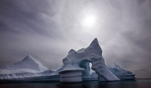
 Fears: NASA scientists say they have 'abundant evidence' that Greenland is losing ice, probably because of global warming
(Source : www.dailymail.co.uk)


